Masterton
Dunfermline, Fife, Scotland
Masterton, Parish of Dunfermline, County of Fife
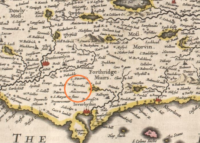
From Fifae Vicecomitatus. The Sherifdome of Fyfe, by Joan Blaeu after James Gordon: Amsterdam: Blaeu 1654. Source: National Library of Scotland
Topographical Dictionary of Scotland
Samuel Lewis. Vol II. Lewis and Co. London 1846.
MASTERTOWN, a village, in the parish and district of Dunfermline, county of FIFE, 1.5 mile (N.) from Inverkeithing; containing 145 inhabitants. This village, which is but of small extent, is situated on an eminence in the south part of the parish, commanding a view of the Frith of Forth and the adjacent country; and is neatly built, on the lands of Pitreavie. An hospital was founded here in 1675, by Sir Henry Wardlaw, proprietor of the estate, who endowed it for four poor widows, who have each an allowance of six bolls of oatmeal, and 40s. in money, annually.
Masterton Genealogy: by Victor A. Noël Paton, W.S.
(Note 1 - 1893)
The tradition regard the name and early history of this property is referred to in the Introduction.
A charter of confirmation by Malcolm III. to the Monastery of Dunfermline (between 1153 and 1160, but undated) contains a grant of the lands of Ledmacduuegil, which afterwards came to be called Masterton. The transition from one name to another is shown by the charters printed in the Reg. de Dunfermline.
William de Masterton, whose ancestors had held these lands for at least five generations, conveyed them to the Monastery of Dunfermline in 1422, as noted in the Introduction. At a later date (1555-83) they appear to have been feued out in small portions (Reg. de Dun., p. 481). The name of William Kent appears among the feuars, and I am informed that, until a recent date, a portion remained in the possession of a family of that name.
The present proprietor of the property bearing the name of Masterton is Henry Beveridge, Esq., merchant in Dunfermline.
The Place-Names of Fife
by Simon Taylor with Gilbert Markus
MASTERTOWN [Dunfermline parish] Settlement; National Grid Ref NT121849; (accurate); OS Pathfinder Sheet 394; Elevation 70 metres; South West Facing
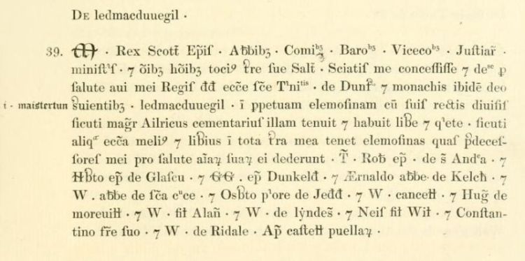
Maistertun 1200 x 1225 RRS i no. 112 [=Dunf. Reg. no. 39; written above Ledmacduuegil in the phrase 'sicuti Magister Ailricus cementarius ('mason') illam tenuit'; in a hand contemporary with that of the main text (see RRS i no. 112 note and Dunf. Reg. p. xix).]
(Hugh of) villa magistri 1225 x 1235 Dunf. Reg. no. 171 [dates approximate]
(William of) Maistertun c.1225 x 1231 Dunf. Reg. no. 174
usque ad diusas de Maistertun 1230 x 1240 Dunf. Reg. no. 198 [as far as the marches of Mastertown]
(William of) Maistertun 1230 x 1240 Dunf. Reg. no. 198
(William of) Maystertun 1272 Dunf. Reg. no. 319
(William de) Maistertun 1278 Dunf. Reg. no. 86
(William of) Meistreton 1296 Inst. Pub.
(Duncan of) Maystertona 1316 Dunf. Reg. no. 348
(John Dauisone of) Mastirtone 1491 Dunf. Recs. {27}
Masterton 1535 Dunf. Reg. Court Bk. 125 [Patrick Robertson and Robert Kent in Masterton]
Maistertoun 1563 RMS iv no. 1476
Maistertoun 1626 Retours (Fife) no. 382
Maisterton 1642 Gordon MS Fife
Mastertoun 1654 Blaeu (Pont) West Fife
Maistertoun 1654 Blaeu (Gordon) Fife
Mastertown 1753 Roy sheet 17,5
Mastertown 1775 Ainslie/Fife
Scots maister 'master' + Scots toun.
'The estate of the master'. The eponymous master is Master Ailric the mason, fl. before 1153, presumably one of those in charge of building work at Dunfermline Abbey. As is clear from RRS 1 no. 112, it was called Ledmacduuegil or Ledmacdunegil before it acquired the name by which we know it today, and it serves as a reminder that names containing the generic toun do not necessarily mean new settlement on land previously unoccupied or unfarmed. It was given to Dunfermline Abbey by King Malcolm IV on the day of David I's funeral (24 May 1153) (RRS i no. 118).
It was known as Maistertun already in the first half of the thirteenth century, as this is written above Ledmacduuegil in RRS 1 no. 112 in a hand of that period (see RRS i no. 112 note and Dunf. Reg. p. xix). Furthermore, in the early thirteenth century William of Maistertun witnesses Dunf. Reg. nos. 174 and 198.
As this name's specific is a common noun whose meaning has been transparent since its coining in the late twelfth century, it has been particularly prone to translation. One of the witnesses to an early thirteenth-century charter (Dunf. Reg. no.171), along with several other Fife land-holders, is one 'Hug[o] de villa mag[ist]ri'; while in Inst. Pub. of 1296, the first element has been translated into Old French to give Meistreton.
Sources:
RRS i Regesta Regum Scottorum vol. i (Acts of Malcolm IV) ed. G.W.S. Barrow, Edinburgh 1960.
Dunf. Reg. Registrum de Dunfermelyn, Bannatyne Club 1842.
Inst. Pub. Instrumenta Publica sive Processus super Fidelitatibus et Homagiis Scotorum Domino Regi Angliae Factis 1291-96, Bannatyne Club 1834 [Ragman Roll].
Dunf. Recs. The Burgh Records of Dunfermline, ed. E. Beveridge (Edinburgh 1917).
Dunf. Reg. Court Bk. Regality of Dunfermline Court Book 1531-1538, ed J.M. Webster and A.A.M. Duncan 1953.
RMS Registrum Magni Sigilli Regum Scottorum ed. J.M. Thomson & others, Edinburgh 1882-1914.
Retours Inquisitionum ad Capellam Domini Regis Retornatarum, quae in publicis archivis Scotiae adhuc servantur, Abbreviatio, ed. T. Thomson (3 vols., 1811-16) vol. 1 Fife and Kinross.
Gordon MS Fife Fyfe Shire MDCXLII - Fife Provincia Noviter Delineata, James Gordon, 1642, NLS (National Library of Scotland). Adv.MS.70.2.10.
Blaeu (Pont) West Fife 'Fifae Pars Occidentalis, The West Part of Fife', Timothy Pont's map of West Fife compiled in the 1590's with minor additions made by Robert or James Gordon, printed in Blaeu 1654.
Blaeu (Gordon) Fife 'Fifae Vicecomitatus, The Sherifdome of Fyfe', James Gordon's map of Fife, completed in 1645, and printed in Blaeu 1654.
Roy 1753 The Military Survey of Scotland, supervised by General William Roy, the 'fair copy', BM. Ref. K. Top XLVIII 25-1b, c; photocopies available in National Library of Scotland (NLS)Edinburgh University, Royal Scottish Geographical Society.
Ainslie/Fife Map of the Counties of Fife and Kinross compiled and engraved by John Ainslie 1775.
The Lands of Dunfermline
by J M Webster - typescript notes in Dunfermline Public Library
THE LANDS OF MASTERTON
There is this to be said for taking the lands of Masterton first that their story reaches further back than that of any of the others - back beyond the time when charters came into use in Scotland, - back to the time when the Saxon Royal Family of England landed at St. Margaret's Hope, in the immediate neighbourhood of what is now Rosyth Naval Base. The course their flight had taken is variously accounted for. One version is that they wished to return to the Hungarian Court, from which they had come to England; but, under pressure of heavy weather, had been driven into the Firth of Forth. Another, quite as plausible, is that Malcolm Canmore, then King of Scots, had, as a young man, fled to the Saxon Court of England on the death of his father Duncan, who had been defeated by Macbeth. He had, in fact, been resident there a considerable time; and, when Edgar and his mother and two sisters were faced with the necessity for flight, it was not unnatural that they should think of him.
Not quite sure of their reception, it was in accordance with the spirit of the times that they should keep a look-out for favourable omens; and when, as they were approaching the land, five sea-birds were observed over-head in the form of a cross; and when, later, on the sails being lowered, the birds landed on the rigging in the same formation, their hearts were much uplifted and they set out on foot with increased hope for Malcolm's Tower at Dunfermline.
The five birds, it is worth noting, were afterwards embodied in the Coat of Arms attributed to Edward the Confessor and St. Margaret - originally sea-birds, then doves, afterwards that heraldic monstrosity - martlets - birds without legs.
Wearied, as they no doubt were, after a long voyage in so small a vessel, the ladies rested for a time on a great stone afterwards known as St. Margaret's Stone - a short distance from the entrance to Pitreavie Castle, on the west side of what is now the road from Rosyth to Dunfermline.
Afterwards, as land came into cultivation, a farm in the immediate neighbourhood was given this same name and, like Masterton, was one of those eventually incorporated in the barony.
Soon after the arrival at the Tower - one of the oldest royal residences in Scotland that can be confidently identified - Malcolm married Margaret, their elder daughter, in a little Celtic Church whose foundations, with its belfry and holy well, can still be seen under the floor of the Nave of Dunfermline Abbey.
Both in Hungary and in England Margaret had been accustomed to the Roman rites and, not taking kindly to the rites observed in the Celtic Church, she prevailed upon her husband to have another church built in the immediate neighbourhood where the service would be such as she had hitherto been accustomed to.
The difficulty was to find an architect, or master-mason, capable of building such a church. There were dry-stone buildings in Scotland before this date; but few, if any, of stone and mortar. The little Celtic Church in which they were married - the date of it can only be a matter of conjecture - had stone foundations, but is unlikely to have been built of stone and mortar.
Faced with this difficulty, their thoughts turned either to other Saxon refugees like themselves who had sought refuge in Scotland, particularly in the Lothians; or to the possibility of inducing a mason to come north from England.
In any case, the difficulty was overcome; the desired church was built; and in the monastic chartulary we find reference to a man, Aelric (Aelricus) by name, presumably a Saxon, described as a master-mason (Magister-cementarius), in possession of the lands of Ledmacduuegil - the spelling varies - in the neighbourhood of Dunfermline; an entry which leaves little room for doubt that these are the lands now known as Masterton (Maistertoun).
The whole question is dealt with at considerable length in Dunfermline Abbey (pp. 215-8) in the light of an old tradition that these lands were given to a master-mason in recognition of work done at the monastery.
The conclusion there reached is confirmed by a letter to the writer of these notes by Mr. John Harvey, author of Gothic England and recognised as the outstanding authority on early ecclesiastical architecture, as follows:-
"You are certainly right in suggesting that "Magister-cementarius" is equivalent to "Master-mason" and that such a master was the nearest equivalent to an architect. I have looked up your references in the Dunfermline "Registrum" (chartulary) and I have not the slightest doubt that Aelricus was the "architect" of the church of Dunfermline in the time of Malcolm Canmore."
The change of name from Ledmacduuegil to Maistertoun was doubtless due to the fact that, in time, people got to know and speak of the place as that where the master-mason lived.
Later, Aelric's successors adopted the name of their lands as their surname, becoming known as Mastertons of that Ilk.
"In 1422 William of Masterton, Laird of Dalis (Dales), quite possibly a descendant of the mason, resigned all his lands into the hands of William, Abbot of Dunfermline, and dedicates to God and bestows on the monks of the Holy Trinity there, all the said lands for the salvation of his own soul and the souls of his predecessors and successors. The church already possessing the superiority, the rights of superior and owner once again merged in the same hands - not now the king's, but those of the Church."
(Dunfermline Abbey, pp. 217/8).
Still later, the lands were divided into eighths - in consideration, one would like to think, of prospective owners who could not afford a larger holding.
Following the Reformation (1560), the superiority of the lands "in terms of a decree before the lords of council" fell into the hands of John Pitcairn of that Ilk, a brother of the Commendator.
Later, they formed part of the "temporal lordship" of the Regality of Dunfermline - the wedding-gift of James VI to Princess Anne of Denmark.
Regesta Regum Scottorum
The Acts of Malcolm IV, 1153-65
112: Grants to Dunfermline Abbey Ledmacduuegil (Mastertown in Dunfermline), as Master Ailric the mason held it.
Edinburgh. (1153 x 1156, probably 1153.1).
M. Rex Scott'. Episcopis. Abbatibus. Comitibus. Baronibus. Vicecomitibus. Justiciariis. ministris. omnibus hominibus tocius terre sue salutem. Sciatis me concessisse dedisse pro salutea aui mei Regis Dauid ecclesie Sancte Trinitatis de Dunfermelin monachis ibidem Deo seruientibus Ledmacduuegilb . in perpetuam elemosinam cum suis rectis diuisis sicuti Magister Ailricus cementarius illam tenuit habuit libere quiete . sicuti aliqua ecclesia melius liberius in tota terra mea tenet elemosinas quas predecessores mei pro salute animarum suarum ei dederunt.
T' Roberto episcopo de Sancto Andrea. Herberto episcopo de Glascu . Gregorio episcopo Dunkeld' .
AErnaldo abbate de Kelch' . Willelmo abbate de Sancta Cruce . Osberto priore de Jedd' . Waltero cancellario
. Hugone de Moreuill' . Waltero filio Alani et W. de Lyndes' . Neis filio Willelmi . Constantino fratre suo . W. de Ridale.
Apud Castellum Puellarum.
Notes:
RUBRIC: (Red, contemporary with text.) DE Ledmacduuegil.
(Black, xv-xvi cent.) Idem quod Maistertun.
Source: Nat. Lib., MS Adv. 34.1.3a, . xr.
Printed: Dunfermline, No. 39.
Footnotes:
1 In No. 118 below, the king states that he made this grant on the day of King David I's funeral
at Dunfermline in 1153, shortly after 24 May. This charter, issued at Edinburgh, probably dates soon afterwards.
In any case, it is earlier than 8 April, 1156 since W[alter] of Ryedale, a witness, was dead before that date (Jaffe-Lowenfeld, Reg. Pont. Rom.
ii, No. 10166a).
a anime probably omitted after salute.
b written over this name, in hand contemporary with text,
is .i. Maistertun.
Regesta Regum Scottorum
Volume I: Acts of Malcolm IV
G.W.S. Barrow
Edinburgh University Press, Edinburgh, 1960
p 178.
Regesta Regum Scottorum
The Acts of Malcolm IV, 1153-65
118: Confirms to Dunfermline Abbey the grants made to the church of the Holy Trinity, Dunfermline (from 1128 the abbey of Dunfermline)
by his predecessors, King Malcolm III, Queen Margaret, King Duncan II, King Edgar, Ethelred, King Alexander, Queen Sibyl and King David I; and further grants
and confirms on his own behalf Ledmacduuegil (Mastertown), 23 acres of arable and a meadow by Dunfermline, and the whole head, except the tongue,
of every whale or other large fish coming to shore or taken in the king's demesne on the Scottish side (of the Firth of Forth).
(19 Dec., 1154 x 1159.)
..........Ego quoque Malcolmus Rex Scottorum ex proprio dono supradicte ecclesie concedo pro salute anime aui mei Regis David aliorum predecessorum meorum & mee . Ledmacduuegil in perpetuam elemosinam cum suis rectis diuisis sicuti Magister AElricus cementarius illam tenuit . quam in die sepulture predicti aui mei eidem ecclesie donando concessi . adeo libere quiete sicuti aliqua ecclesia melius liberius in tota terra mea tenet suas elemosinas. Dono etiam eidem ecclesie .xx. tria jugere terre. quoddam pratum prope Dunfermelin que prius in meo dominio habui.......
Ego Robertus Sancti Andree episcopus confirmo. Ego Herbertus Glascuensis episcopus confirmo. Ego Gregorius Dunkeldensis episcopus confirmo. Ego Andreas Catenensis episcopus confirmo. Ego Christianus Witernensis episcopus confirmo. Huius etiam priuilegii testes assertores sunt. Walterus Cancellarius . Hugo de Moreuill' . Walterus de Lyndeseia . Gillebertus de Umfrauill' . Walterus filius Gilleberti1. Philippus de Coleuill' . Gospatricius filius Waldef . Robertus Auenel . Nicholaus clericus . Dauid Olifard' . AElwynus filius Arkil . Et de Comitibus . Gospatricius comes . Ferteth comes . Duncanus Comes. Morgund Comes . Melcolmus comes . Comes de Anegus.
Notes:
RUBRIC: Confirmacio Malcolmi Regis. (Red, overlaid with white.)
Source: Nat. Lib., MS Adv. 34.1.3a, fo. xir-v The original was apparently preserved at Pinkie House until 1624; cf. SHR, xxxvi (1957), p. 138.
Printed: Dunfermline, No. 35.
Footnote
1 Probably Walter, son of Gilbert, son of Richard of Clare. Walter was brother of Gilbert, first earl of Pembroke and therefore brother-in-law
of Isabel, half-sister of King Malcolm's mother, Ada de Warenne.
Regesta Regum Scottorum
Volume I: Acts of Malcolm IV
G.W.S. Barrow
Edinburgh University Press, Edinburgh, 1960
p 182.
Regesta Regum Scottorum
The Acts of William I, 1165-1214
30: Confirms the property and privileges of Dunfermline Abbey, adding to the gifts of previous kings 100S. from the firma burgi of
Edinburgh, given on the day of King Malcolm IV's funeral, and 20 acres of arable and one toft in Dunfermline.
St. Andrews.
(1165 x 23 September, 1168, probably c. 1166)
..........Dec dono Regis Malcoli fratris mei Ledmacduuegil sum suis rectis diuisus. sicut magister AElricus cementarius illam tenuit . quam in die sepulture predicti aui mei eidem ecclesie obtulit . .xxtiiiia . tria jugere terre. quoddam pratum prope Dunfermelin que prius in dominio suo habuit.........
Testibus hiis Dauid fratre Regis . Nicholao cancellario . Duncano comite . Dauid Olifard . Philippo de Valloniis. Ricardo de Quinci . Jordano Ridel . Radulpho de Cler . Radulpho Malchael . Gillecrist mac Samuel . Galfrido de Maleuill' . Waltero de Berkelai. Apud Sanctum Andream.
RUBRIC: Confirmacio Willelmi Regis. (red with blue initial).
SOURCE: NLS, MS Adv. 34.1.3a, fo. xiiiir-v.
PRINTED: Dunfermline, No. 50.
NOTES
c Blue initial.
COMMENT. Probably issued soon after the king's accession.
Regesta Regum Scottorum
Volume II: Acts of William I
G.W.S. Barrow with W.W. Scott
Edinburgh University Press, Edinburgh, 1971
p 140.
Registrum de Dunfermelyn
1200-1225
reproduced from Registrum de Dunfermelyn, page 23, Bannatyne Club, Edinburgh, 1842.
Registrum de Dunfermelyn
1230-1240
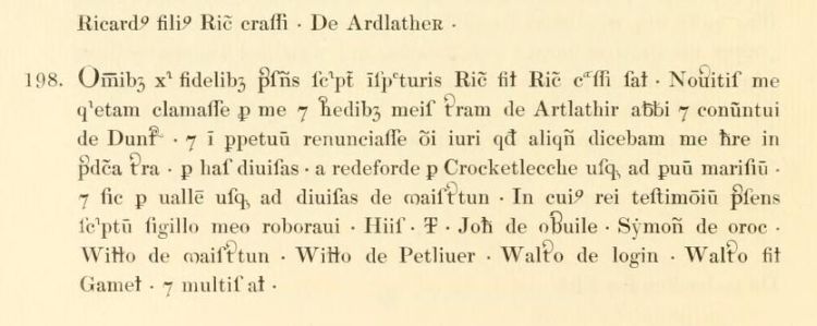
reproduced from Registrum de Dunfermelyn, page 112, Bannatyne Club, Edinburgh, 1842.
Regesta Regum Scottorum
Acts of Alexander III, 1249-1286
Charters
By the later thirteenth century the clerks of the royal chancery appear to have viewed as archaic the once popular instrument of conveyance known as the diploma, its long clauses of invocation needlessly cumbersome. Yet features of this style might on occasion still serve a useful purpose. The monks of Dunfermline abbey had long been partial to the solemnity associated with the pious language and prolixity of the royal diploma, and in 1277 again opted for this style of document in Alexander III's general confirmation of their possessions and privileges.
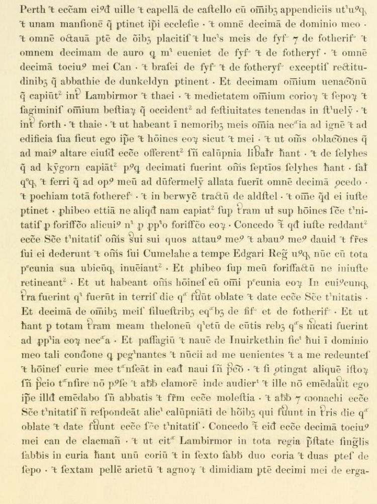
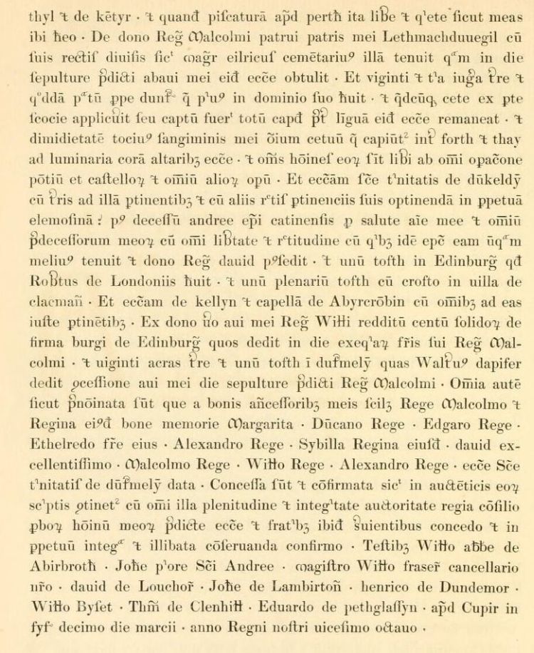
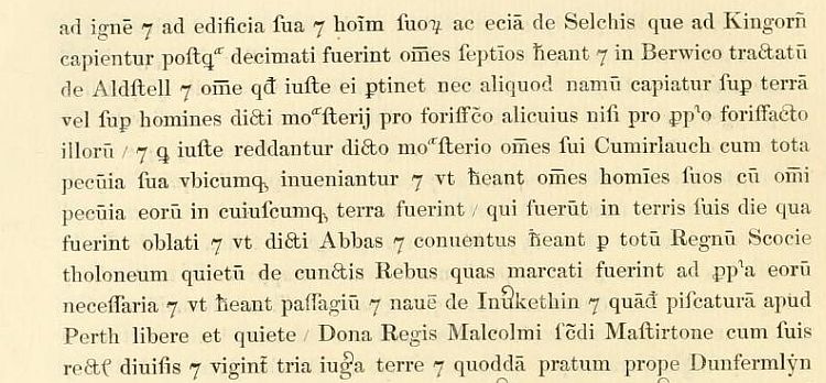
102 Grants and confirms in perpetual peace to the church of Dunfermline, with the agreement of his bishops, earls and barons and the agreeement of his clerics and people, all the gifts and rights that the church has received from his ancestors, namely, from King Malcolm and Quen Margaret Broomhill, Urquhart, Pitbauchlie, Pitcorthie, Pitliver, (Wester) Bogie, the shire of Kirkcaldy and 'Little Inveresk' (all in Fife); from King Duncan two touns called Luscar (Fife); from King Edgar the shire of Gellet (Fife); from AEthelred Hailes (Midlothian); from King Alexander Primrose, the shire of Goatmilk, Pitconmark, Balwearie (Fife), 'Drumbernin' and Keith (Humbie, East Lothian); from Queen Sybil Beath (Fife)...
....Confirms to the abbot and monks other gifts from his predecessors, namely, from King Malcolm Lethmacdunegil (Mastertown, Fife), as Master AElric the mason held it, which Malcolm offered to the abbey on the day when King David I was buried; near Dunfermline twenty-three iugera of land [approximately 15 acres] and a meadow which King Malcolm formerly had in his demesne; and the whole head, except the tongue, of every whale which comes to shore or is caught on the Scottish side of the Forth; half the fat of all the whales caught between the Forth and the Tay to which he is entitled for lighting the altars of the church. Grants also that their men should be free from all labour service on the bridges, castles and other works.........
Grants and confirms to the monks all these gifts and possessions just as they are set out in the church's authentic charters; these are to be preserved whole and unaltered for ever. Cupar (Fife), 10 March a.r. 28 [1277].
NOTES. aRubric and initial in red. bPetcomarthy in printed version. cSic, apendiciis. dPetiocher in printed version. eSic, piscibus. fThe word uille is struck out here and burgo written over it. gSic, posset. hFor an argument in favour of 'Lethmacdunegil' rather than 'Lethmacduuegil', see S. Taylor with G. Markus, The Place-Names of Fife, Vol. I (Donington, 2006), 331. iA measure of land: one iugum was equal to two-thirds of an acre.
RUBRIC. Confirmacio domini regis (thirteenth century).
SOURCE. NLS, Adv. MS. 34.1.3A, Register of Dunfermline Abbey, fos xviiiv-xixv.
PRINTED. Dunfermline Registrum, no. 81.
COMMENT.'Drumbernin' may be Dumbarrow (Perthshire), formerly a part of Fife, but possibly also Dunbarney in Perthshire. See Place-Names of Fife, i, 41. For Aldstell, now Calot Shad, see RMS, ii, no. 429 and Dunfermline Reg., no. 461. A modern transcript appears in NRS, RH 2/5/5.
Regesta Regum Scottorum
Volume IV. Pt I: Acts of Alexander III
Cynthia J. Neville, Grant G. Simpson (eds)
Edinburgh University Press, Edinburgh, 2012
pp 8,134-137.
Registrum de Dunfermelyn
1277
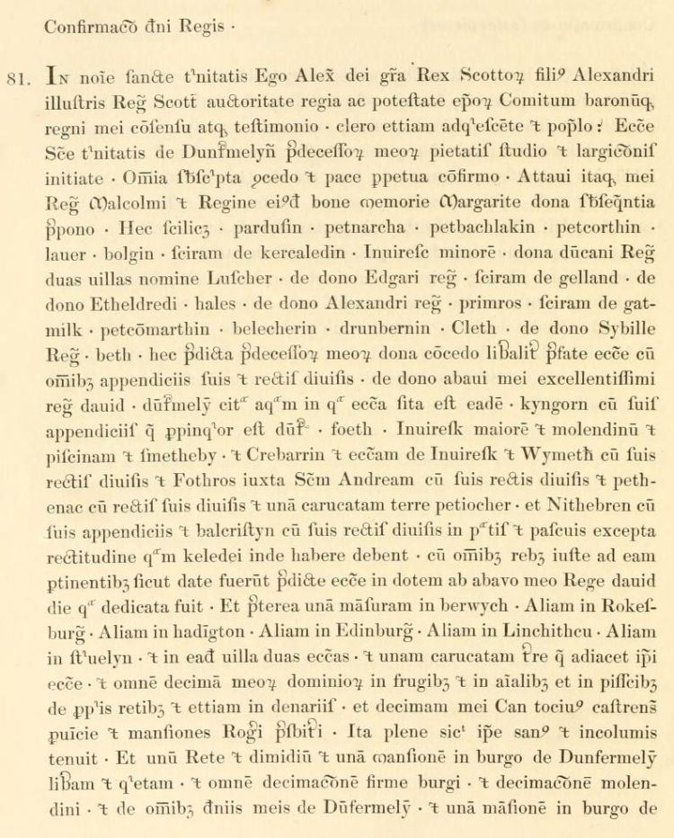
reproduced from Registrum de Dunfermelyn, pages 46-8, Bannatyne Club, Edinburgh, 1842.
Acts of the Lords of Council in Civil Causes
1496-1501
2 December 1500: Bruce of Clackmannan. Menteith of Caverca. Contract of marriage. Failure to procure dispensation. Fol. 214b.
Action by David Bruse, younger of Clakmannane, against John Menteith of Caverca "for the wrangus postponyng and differring til raise and bring hame ane dispensacione fra the Court of Rome for the completing and solempnyng of lauchfull matrimone and mariage betuex the sade Jhone and Marione Bruse, dochter to the sade David Bruse, elder, and sister to David Bruse, younger, efter the forme of the indenturis." The pursuer compearing by Edward and Robert the Bruse, his procurators, and the defender personally, the Lords ordain the said John to deliver to the said David "the autentik copy under ane transsumpt of the sade Marione conjunct feftment of the sadis landis of Caverca, togiddir with the rentalling of the takkis of the landis of Dalgrane, the Colzare Raw myln, Petbaithle, with the auchtene part of Maistertoune, for als mony termes and yeris as he has of the sammyn, efter the tenore of the endenturis made betuex thame, schawin and producit before the Lordis; and als decretis and deliveris the sade Jhone til be qwyt of the clame of five hundreith merkis clamyt be umquhile David Bruse, elder of Clakmannan, and David Bruse, yonger, for thair costis, dampnage and expensis, because he failyeit til mak resignatione of his landis and til bring hame the sade dispensacion, sen that the sade Jhone of Menteith has producit ane lauchfull resignacione and conjunct feftment, dispensacione and ane sufficient rentaling of the sadis Marione in presens of the sadis Lordis."
Acts of the Lords of Council in Civil Causes
Volume II: 1496-1501
George Neilson & Henry Paton
House of Commons, London, 1918
p. 456
Registrum de Dunfermelyn
1540
James II granted to the Abbot and Convent of Dunfermline a Charter of Confirmation of all their possessions, including Mastirtone, the gift of King Malcolm.

Text redacted
Text redacted
reproduced from Registrum de Dunfermelyn, page 320-324, Bannatyne Club, Edinburgh, 1842.
Registrum de Dunfermelyn
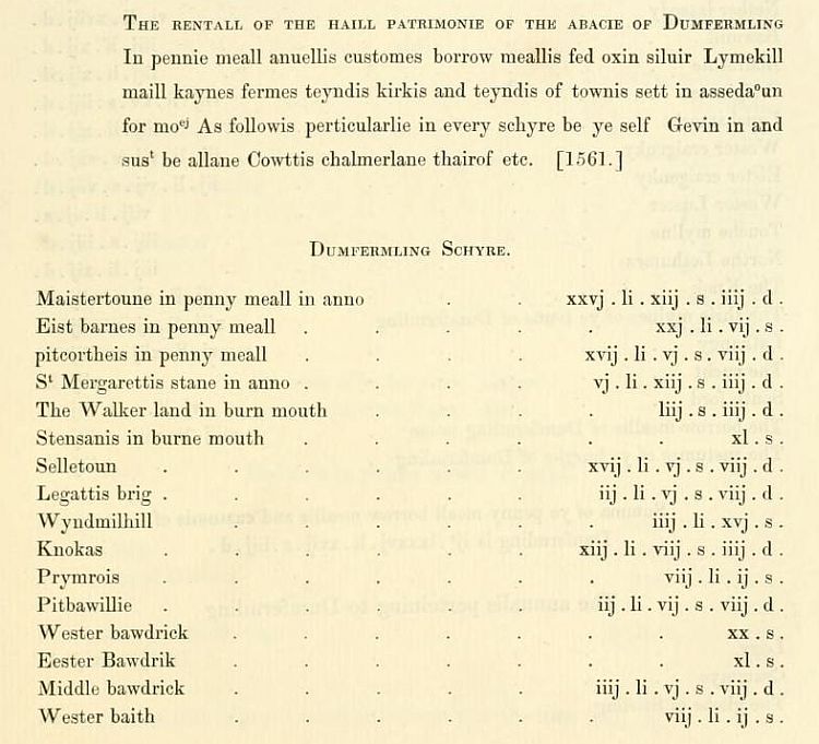
Appendix II; 1561
In the rental of 1561, Maistertoune has the largest of the contributions in "Dunfermling Schyre" and one of the largest in Fife.
Text redacted
reproduced from Registrum de Dunfermelyn, page 425, Bannatyne Club, Edinburgh, 1842.
Registrum de Dunfermelyn
Appendix III
Registra Infeodacionem et Alienationum
1. The buik withe the blak covering Callit nouum rentale Begynnand in 1555 and endand 1583.
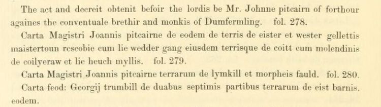
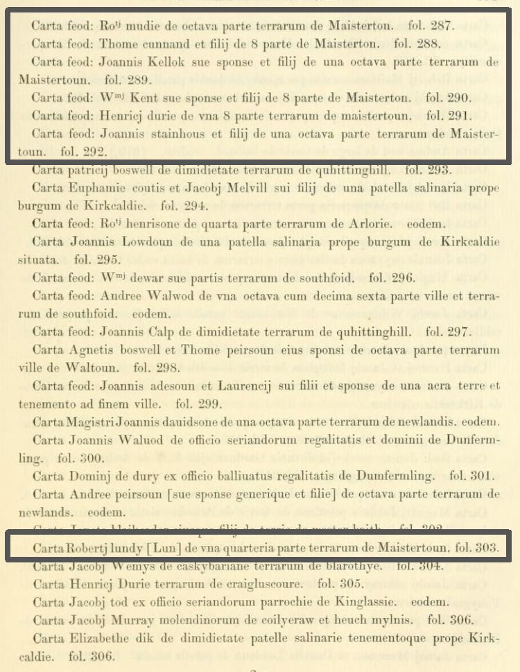
reproduced from Registrum de Dunfermelyn, page 480, 481, Bannatyne Club, Edinburgh, 1842.
Registrum de Dunfermelyn
Appendix III
Registra Infeodacionem et Alienationum
3. The register with the quhyt parchment covering. [1557-1585.]
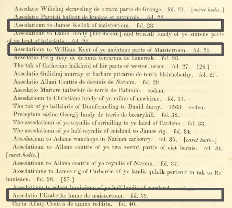
reproduced from Registrum de Dunfermelyn, page 487, Bannatyne Club, Edinburgh, 1842.
Calendar of the Laing Charters 854-1837
c.-1575
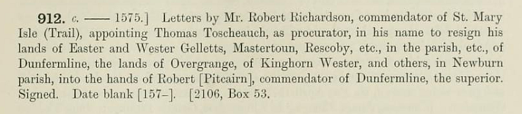
reproduced from the Calendar of the Laing Charters, page 229. James Thin for the University of Edinburgh, 1899.
Calendar of the Laing Charters 854-1837
10th Feb 1579
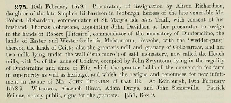
reproduced from the Calendar of the Laing Charters, page 243. James Thin for the University of Edinburgh, 1899.
Calendar of the Laing Charters 854-1837
24th Sep 1579
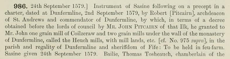
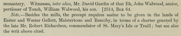
reproduced from the Calendar of the Laing Charters, pages 245-6. James Thin for the University of Edinburgh, 1899.
Dunfermline Regality Register of Decreets 1582-1595
24 March 1592
Division of lands between the portioners of Masterton
- Robert Lunn: His old toftstead back and fore extending to 4 score forluds. More he shall have 16 roods lying next adjacent to him in the east side of his barn yard which belonged before to Robert Moodie and Robert Kellock. More he shall have 4 roods on the west side of his barn and barn yard lying next thereto containing in the whole 6 score 4 roods.
- Robert Moodie: His old toftstead containing forty four roods in the north side. More shall have 16 roods lying next adjacent to the mair yard called the Holl Yard, containing 3 score roods.
- Thomas Stanhouse: Shall possess his old toftstead and the bands of the house at the house neuk containing 3 score roods.
- William Kent: To possess his old toftsteid back and fore containing 51 roods and xxx roods. More he shall have 9 roods lying in the hill to xxx to him, containing 3 score roods half rood with a rood on the east side of his barn with half an ell on the backside of his ox byre.
- Margaret McBaith and George Durie her son: The whole main yard extending to 32 roods and tos ane privilege to remove the dyke of the mane yard eastward less one ell to have loan (path). More they shall possess their old tosteid there next to them.
- Thomas Cunnan: 23 roods with 5 roods lying in the hill, extending to 3 score roods. His old tosteid extending to 37 roods. More he shall have on the east side of the old tosteid 23 roods which belonged to Henry Durie extending to 61 roods.
- Robert Kellock His old toftstead within his dykes and possession extending to 53 roods. More he shall have 7 roods of Henry Durie's toftsteid lying next to William Kent, extending in the whole to 3 score roods.
And both the said parties dwelling on both sides of the lone to have privilege to shull to gather fulzie from the myd of the lone only, and according to the roods designed to each man.
Dunfermline Regality Register of Decreets 1582-1595
31 March 1592
The portioners of Masterton compeared re the division:
Robert Lunn freely exchanged the 9 roods lying in the hill pertaining to William Kent and heapetoin to the said William therefore 9 roods of land lying on the north end of the said Robert's rigs, lying on the west side of the wynd, ane gait to lie between the mane yard and the said 9 roods of ten foot breadth. And if the said Robert tak his own daill rudin yairdin for his own commodity that not to be counted in tosteine but esteemed to be steid land. Also all the tenants and feuars obliged themselves to hold the whole lone of the said onn free containing 8 ells broad and that they nor none of them shall have privilege to make or lay ane middens steid on within the bounds and property of the said lone but to lie free all guds each man for net his own head room to have privilege to lay xxx to the middle of the lone and to gidder and shull the same to his own behoof.
Registrum de Dunfermelyn
Appendix III
Registra Infeodacionem et Alienationum
4. [Registrum pergameneum cartarum Anne Regine. 1593-1600.]
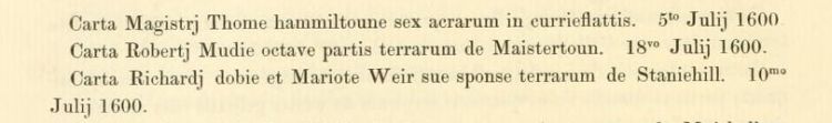
reproduced from Registrum de Dunfermelyn, page 496, Bannatyne Club, Edinburgh, 1842.
Calendar of the Laing Charters 854-1837
28th June 1617
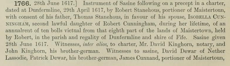

reproduced from the Calendar of the Laing Charters, pages 428-9. James Thin for the University of Edinburgh, 1899.
Retours of Services of Heirs
Fife
JOANNES STANEHOUS, haeres provisionis Roberti Stanehous portionarii de Maistertoun, patris,-in 3 quarteriis villae et terrarum de Southseid, in parochia et regalitate de Dunfermline. - E. 8l. 16s. &c. ix. 132.
ROBERTUS MUDIE, haeres Thomae Mudie portionarii de Maistertoun, patris,-in octava parte villae et terrarum de Maistertoun: - E. 4l. 13s. 4d. &c.- Terris de Baithbell etc
Retours of Services of Heirs
Volumes I-III: 1544-1699
Thomas Thomson
House of Commons, London, 1811
Historical Tales of the Wars of Scotland
Vol I.
A.D. 1651.
WHILE Charles II. was in Scotland, during Cromwell's campaigns to establish the authority of the newly erected Commonwealth, the citizens of Perth, by order of the King, assembled on the fine plain called the South Inch, and selected a chosen body of men who were to march to Burntisland and watch the motions of the Republican fleet and army. This company, under the command of a gentleman named Butler, joined a detachment of the Scotish army from Dunfermline, consisting of three thousand men who were posted on an eminence near the ancient royal burgh of Inverkeithing in Fife, under the command of Major-General Sir John Brown of Fordel and Major-General Holburne of Menstrie. There is a promontory called the Cruicks, running into the Frith of Forth above North Queensferry, noted for a project entertained by some foreign wealthy Jews in the reign of Alexander III. to fortify and erect upon it a sort of new Jerusalem - a design which was relinquished probably on account of the interference of the government. Near this promontory Colonel Overton, with about fourteen hundred infantry and some cavalry, landed and encamped to check the Scots, and shortly afterwards Lieutenant-General Lambert crossed with two thousand five hundred cavalry and infantry of the Republican army, to repel the Presbyterian forces from Fife.
On the first day after the encampment of the English there was a small skirmish upon the rocky hills overlooking the Queensferry and the Frith of Forth, but the severe engagement, which was maintained with much obstinacy on both sides, and terminated in the defeat of the Scots, was begun near the town of Inverkeithing, at a place called Hillfield. On account of the Scots retreating, however, the battle was chiefly fought upon the opposite bank of Masterton, which, though not far distant, lies within the parish of Dunfermline. The Scots received such a severe check that sixteen hundred were killed and wounded, and twelve hundred were taken prisoners at Inverkeithing and Dunfermline, with fifty-two drums, several bagpipes, and colours. Among the wounded were Sir John Brown of Fordel, and several officers of distinction.
A rill traversing the valley where this battle was fought, called Pinkerton Burn, is said to have been coloured with blood for three days in consequence of the great slaughter. In the language of the old people of Inverkeithing the plain was like a hairst field with corpses - meaning a field thickly strewed with newly cut sheaves of grain. MacLean of Dowart, chief of the Clan MacLean, lost six sons in this combat, each of whom was successively cut down as they all came up to defend their father. A diarist of the time says that "Holburne was employed with some horse and a great number of foot to march upon the enemy. MacLean of Dowart, with five hundred of his soldiers and sundry others of the foot companies, went on courageously, and looking that Holburne would have assisted them with his horse; but they were deceived, for the horse never went on to their help. And so the English won that day, and slew and deadly wounded twelve hundred foot and two hundred horse; Sir John Brown taken prisoner, and the whole name of MacLean destroyed, being all gallant men and able, passing the number of five hundred men at least, they and their followers."
Another contemporary annalist observes - " Our party (the Scots) was commanded in chief by Lieutenant-General Holburne, who that day by all honest men was thought to have played the traitor, but he was formally cleared at Stirling thereafter, and quitted his charge in the army, for the whole army exclaimed against him." The people of Inverkeithing have a traditionary story, in confirmation of Holburne having betrayed his trust, that he stood on the East Ness, and invited the English general across the Frith, which is here very narrow, by a trumpet. Sir John Brown of Fordel, who behaved with great fidelity and gallantry on this occasion, was sent a prisoner to Edinburgh Castle, and he soon after died of grief at his defeat.
The loss on each side is variously stated. There can be little doubt that the slain on the side of the Scots as above stated is nearly correct. Yet we are told by an annalist of the time already cited, that "there were killed almost alike on each side, and of the Scots about eight hundred, most of them foot." He most absurdly adds that the English amounted to ten thousand men. Cromwell, in his official account, says, that the Scots lost two thousand men, with about five hundred or six hundred prisoners. Lambert estimated the slain at the same number, but maintains that the prisoners exceeded fourteen hundred, while he limits the loss of the English to only eight men - "so easy did the Lord grant that mercy." No confidence, in fact, can be placed in the statements issued by the contending parties in this war, which is evident by a comparison of the official returns of the casualties sustained by each in this and other engagements. We shall in another place follow Cromwell to Perth, and notice his doings in the Fair City.
* Nicoll's Diary ; Memorabilia of Perth ; Statistical Account of Scotland ; Cromwell's Dispatches ; Sir James Balfour's Annals.
Historical Tales of the Wars of Scotland
and of the Border Raids, Forays, and Conflicts.
Volume I
John Parker Lawson
Edinburgh, London and Dublin. A Fullarton & Co., 1839
pp 323-5.
Calendar of the Laing Charters 854-1837
15th April 1655
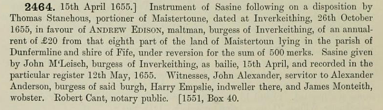
reproduced from the Calendar of the Laing Charters, page 578. James Thin for the University of Edinburgh, 1899.
Caledonian Mercury
GLASGOW AGRICULTURAL SOCIETY. - The third annual prize show of stallions, under the auspices of the Glasgow Agricultural Society, took place on Tuesday in the Cattle Market, Duke Street. There were twenty entries, but only nineteen animals were exhibited. The show was altogether a very fine one, and attracted a great multitude of spectators. A committee of the directors of the Agricultural Society acted as judges, and awarded the first premium - 30 sovereigns and a silver medal, to Mr Charles Phillips, Brompton, Cumberland, for his fine grey stallion, Merry Tom. This beautiful animal, now aged six years and eight months, has gained this same prize for three years in succession. The second premium - 30 sovereigns, was adjudged to Mr Alexander Drummond, Masterton, Dunfermline, for his five-year-old dark-brown stallion, Heather Jock.
Caledonian Mercury
Thursday, 1st March 1855
The community of Masterton probably reached its greatest extent in the mid-19th Century. The 6-inch Ordnance Survey shows a sizeable group of buildings, including Pitreavie's Hospital.